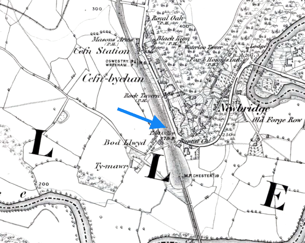
Notes: Rhosymedre was the temporary southern terminus of the Shrewsbury & Chester Railway (S&CR) when its first section opened from Saltney Junction (near Chester) on 4 November 1846. The S&CR was formed in July 1846 out of a merger of the North Wales Mineral Railway (NWMR) and the Shrewsbury, Oswestry & Chester Junction Railway (SO&CJR). The NWMR had started the construction of a line between Saltney Junction (near Chester) and Ruabon via Wrexham in 1844. The SO&CJR was set up to create a route between Shrewsbury and Chester and the merger enabled that task to be carried out through an extension of the NWMR line.
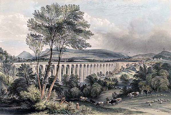
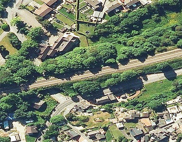
 Little is known about Rhosymedre which was probably a simple timber construction. It was located on the north side of the Vale of Llangollen at its eastern end half a mile to the south of its namesake. The River Dee flowed through the vale which was a steep sided valley at this location, and to cross it the S&CR had to build the 19-arch Dee viaduct. Engineered by Henry Robertson and built by the contractor Thomas Brassey the viaduct was constructed from stone with brick interior arching. It was 503yd long and 147ft high at the point where it crossed the river. Little is known about Rhosymedre which was probably a simple timber construction. It was located on the north side of the Vale of Llangollen at its eastern end half a mile to the south of its namesake. The River Dee flowed through the vale which was a steep sided valley at this location, and to cross it the S&CR had to build the 19-arch Dee viaduct. Engineered by Henry Robertson and built by the contractor Thomas Brassey the viaduct was constructed from stone with brick interior arching. It was 503yd long and 147ft high at the point where it crossed the river.
During the construction of the viaduct Rhosymedre acted as a railhead and journeys to and from the south would have been by road coach. Trains ran north to Chester and there were six in each direction.
The railway was not the first transport undertaking that had to contend with the Vale of Lllangollen at this point. In 1805 Pontcysyllte Aqueduct had opened less than a mile to the west for the Llangollen canal. Engineered by Thomas Telford and William Jessop the aqueduct was 337yd long and towered 126ft above the valley making it an imposing structure.
On 14 October 1848 the line between Rhosymedre and a temporary station at Shrewsbury opened. From this date services began to run south to Shrewsbury and from 23 December 1848 also to Oswestry.
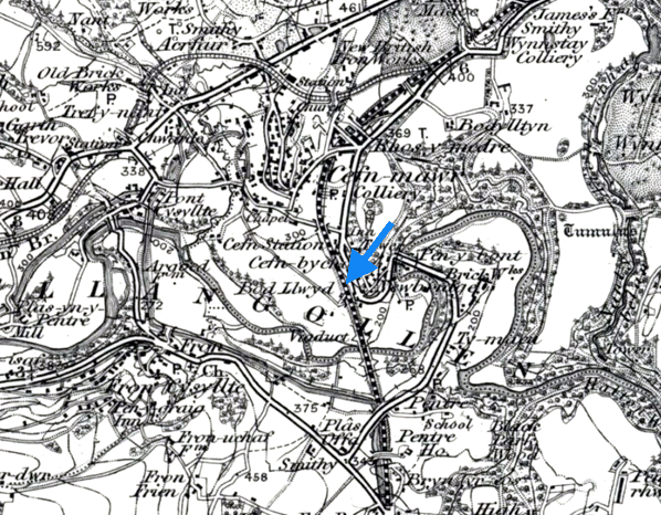
In July 1849 Rhosymedre was closed after it was replaced by a station called Cefn 20 chains to the north.
On 1 September 1854 the S&CR was taken over by the Great Western Railway (GWR) and it went on to become a major trunk route of the GWR linking London Paddington to the River Mersey at Birkenhead.
Route map by Alan Young
Sources:
- A Regional History of the Railways of Great Britain - Volume II North & Mid Wales - Peter E Baughan - David & Charles 1980.
- Encyclopaedia of British Railway Companies - Christopher Awdry - Guild Publishing 1990.
- Paddington to the Mersey - Dr R. Preston Hendry & R. Powell Hendry - Oxford Publishing Company 1992.
- Railway Passenger Stations in Great Britain - A Chronology - Michael Quick - Railway & Canal Historical Society 2009.
To see the
other stations on the Shrewsbury - Chester General line
click on the station name: Shrewsbury S&C, Leaton, Oldwoods Halt, Baschurch,
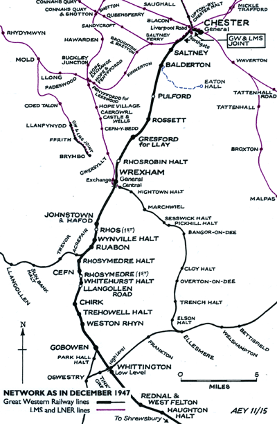
Stanwardine Halt, Haughton Halt, Rednal & West Felton, Whittington Low Level, Weston Rhyn, Trehowell Halt, Llangollen Road, Whitehurst Halt, Cefn, Rhosymedre Halt, Wynville Halt, Rhos, Johnstown & Hafod, Rhosrobin Halt, Gresford, Rossett, Pulford, Balderton and Saltney
To read more about the Shrewsbury & Chester Railway company click here |

.jpg)
.jpg)

 Home Page