
Station Name: MICKLEHURST[Source: Alan Young]
Micklehurst Station Gallery 1: c1911 - c1930s 1.jpg) Photographs of Micklehurst Loop passenger stations prior to closure have proved elusive. This one of Micklehurst is thought to be circa 1911; the station closed in 1907. The view is north-west across Station Road. The substantial brick villa is in the style used at all four of the Loop’s stations. In contrast the platforms and their associated buildings are of timber. The use of timber, rather than masonry, for the platforms and their buildings reduced the load that the embankment carried. A generous awning extends over the passenger entrance to the booking hall, with a more modest one over the door of the station house. The stairway up to the platform is covered, and awnings are provided in front of both of the platform buildings. The up platform building (right) was reconstructed after being severely damaged by a fire in 1893 thought to have been caused by a spark from a passing locomotive.
Photo from Tameside Archives 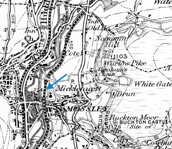 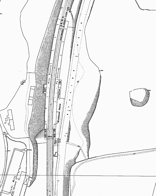 1892 1:500 Town Plan. Mossley was considered important enough to warrant a large scale plan (about 1in to 41ft) and coverage extended to the new station at Micklehurst. On the west side of Station Road the station house (not named) and adjoining booking hall (named ‘Booking Office’) are shown, as is the canopy, shown by cross-hatching above the booking hall door. From the booking hall passengers would reach the foot of the staircase to the up platform or use the subway (named) to reach the staircase to the down platform. Hachures are used, mainly west of the railway, to show that the platforms are on an embankment. Two waiting rooms, a toilet (not named) and a porters’ room are identified in the up platform building, and a single waiting room (with toilet) on the opposite platform. No awnings are shown on these buildings. Since the small canopy is shown on the booking hall at this time it is assumed that the platform roofing had yet to be provided. Click here for a larger version
 1892 1:500 Town Plan. The goods facilities at Micklehurst were entirely separate from the passenger station. The goods warehouse is identified as ‘Goods Station’. Two sidings pass through the warehouse; the protrusion at the northern end is the weigh office and a crane is shown at the southern end. The coal depôt with its weigh office (WM=weighing machine) is at the northern end of the site. Three further loop sidings and three dead-end ones are also shown. The goods facilities are on the up (east) side of the running lines, although one siding is to their west, as is the signal cabin: no cabin was provided at the passenger station. A level site for Micklehurst goods station had to be created by cutting into the eastern hill slope and constructing a broad embankment on the west side, presumably using the rock hewn from the eastern side. The plan shows the steep slope down to the towing path of the Huddersfield Canal, strengthened at intervals with masonry structures. Click here for a larger version.
 1895 1: 10,560 map. The considerable distance between Micklehurst passenger and goods stations can be seen. Micklehurst passenger station is clearly better placed than the goods facility to serve the population of Mossley; but Mossley station, on the ‘old’ line from Diggle to Stalybridge is clearly better sited still, being adjacent to the town centre and with some residential development to the west.
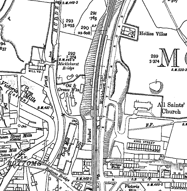 1909 1: 2,500 OS map. Micklehurst passenger station has now closed, but was probably open when the survey and drawing were done. The platform roofing is indicated by pecked lines at the edges of the canopies. Urban and industrial development is in progress close to the station, with an oil and grease works to the west, and All Saints’ church and a residential terrace (King Street) recently constructed to the east.
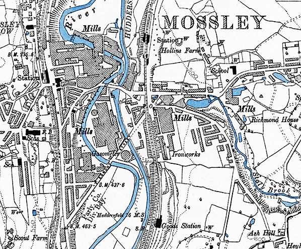
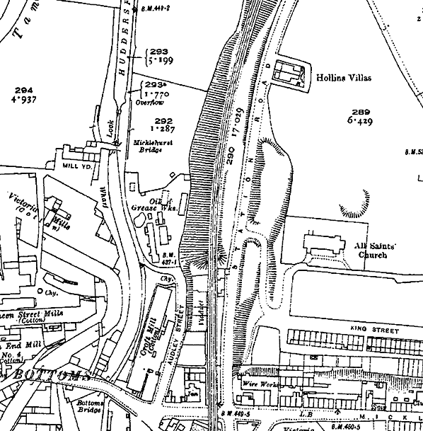 1922 1: 2,500 OS map. Micklehurst passenger station is no longer identified by name, having closed 15 years earlier, and it seems that the timber platforms and their buildings have been demolished. The station house and booking hall are in place – as they still are in 2015.
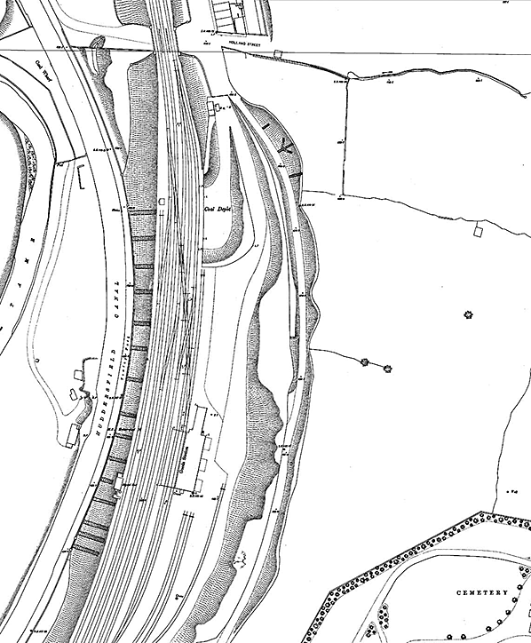
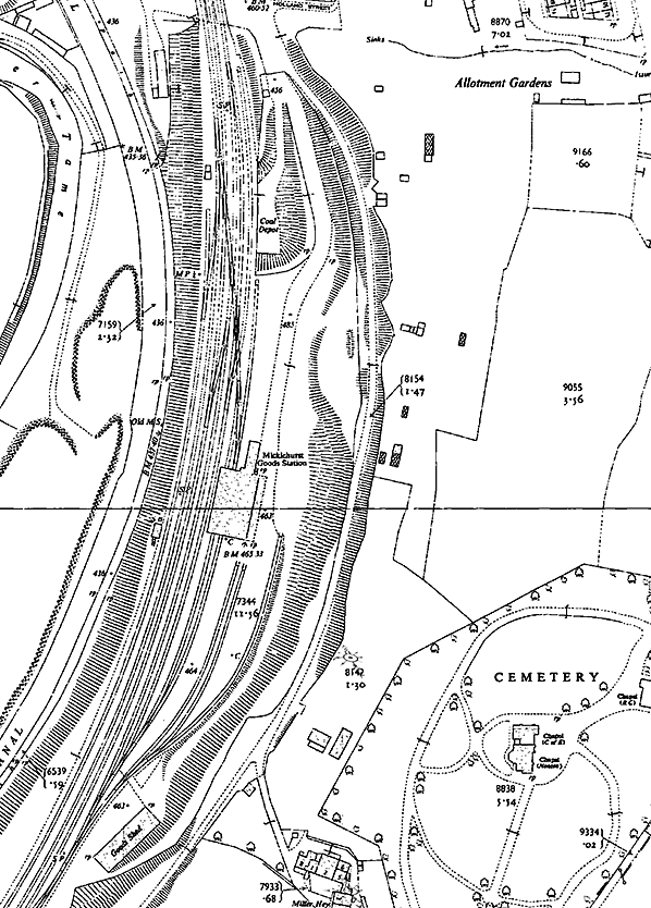 1955-56 1: 2,500 map. ‘Micklehurst Goods Station’ is now named on the map, adjacent to the original goods warehouse. A second goods shed is named at the southern end of the yard where the stable used to stand. Little else has changed. Click here for a larger version.
 Looking south-east towards Micklehurst station circa 1911. The rear of the down platform’s timber building can be seen. The prominent spire of All Saints’ Church (founded 1895) is beyond the station.
Photo
from Tameside Archives
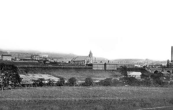
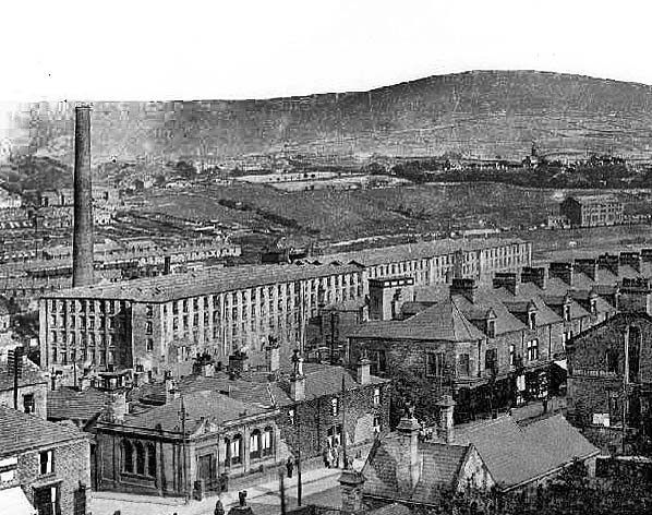 Looking south-east across Mossley town centre c1910 towards Micklehurst goods station. The goods warehouse can be seen in the distance towards the right-hand edge of the photo. In the foreground, lower right, is Mossley station on the ‘old’ line between Diggle and Stalybridge; this station is still open in 2015. The view is dominated by the two South End cotton mills.
Photo from Tameside Archives 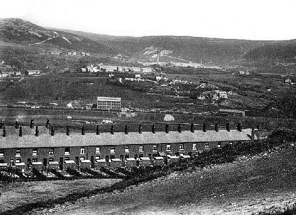 Looking east towards Micklehurst goods station c1910. The goods warehouse is just left of centre. The terraced houses of Andrew Street stretch across the view.
Photo
from Tameside Archives
Click here for Micklehurst Station Gallery 2:
|
 The two facing platforms were detached from the station house and office range. They were of timber construction, about 490ft in length and built on an embankment immediately north of the viaduct. The waiting sheds/porters’ room on the platforms were also of timber construction. The use of timber, rather than masonry, for the platforms and their buildings reduced the load that the embankment carried. Access to the up platform was by means of a staircase enclosed in a timber shell with a glazed roof, and a subway and staircase led to the down platform.
  As the timetables for 1887 and 1895 (above) show, Micklehurst – together with the other three stations on the Loop- did not enjoy a generous service; there were no trains on Sunday. Even though there were, within five-to-ten minutes’ walk of the station, three cotton mills, an iron works and a cart and carriage works and several residential streets, there was no development to the north and east. Mossley station, on the main line, was also just a few minutes’ walk from these factories and streets and much better placed to serve the town as a whole and this station had more frequent trains, operating straight through to Manchester. From Micklehurst passengers to Manchester had to change at Stalybridge. Thus it was that Micklehurst was so little used that it closed to passengers in 1907 – the first of the stations on the Loop to close, and at a time when station closures were rare. The ‘Beeching Axe’, which is carelessly given so often as the cause of all closures, had yet to be sharpened: indeed it was six years after Micklehurst’s closure that Dr Beeching was born.
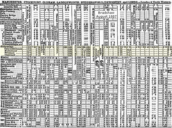

 Home Page