
Station Name: SHAWFORTH[Source:
Alan Young]
Shawforth Station Gallery 1: Early 20th Century - 1959 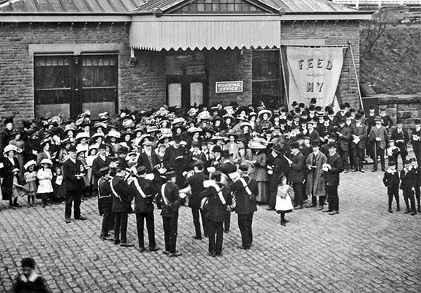 The forecourt and booking hall of Shawforth station are seen in the early twentieth century, looking west. A prominent canopy with a deep, frilly valance provides shelter over the entrance to the station and the hipped roof is supported by a row of small brackets. The booking hall leads directly to the subway - which passes beneath the siding into the coal yard - and it gives access to both platforms. A church gathering is in progress, perhaps a fund-raising event or a Sunday School anniversary with a railway excursion as part of the festivities. Participants of all ages are smartly attired, all sporting headgear, and many holding hymn sheets as the band leads them in worship. The large banner in front of the building probably carries the scripture, ‘Feed My Lambs’ (John 21:15). The stone setts of the forecourt appear spotless, no doubt swept clean by the dutiful station staff in preparation for
the joyful occasion. Photo from Whitworth Historical Society 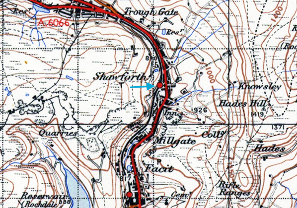 
1935 Street map. Click here for a larger version
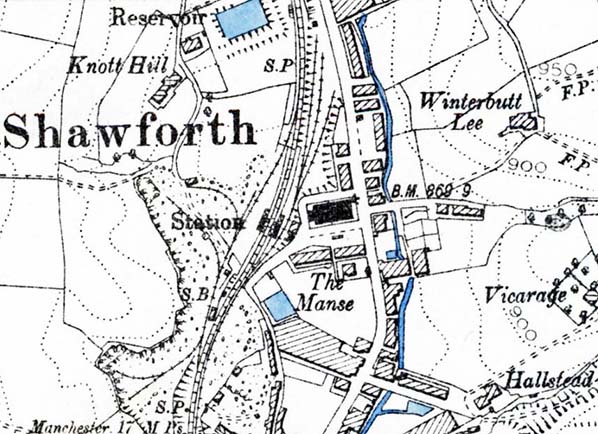
1891 1: 10,560 OS map. Buildings of identical size are shown at Shawforth station on each side of the double-track railway, and the separate booking hall is on the roadside east of the station. A long loop is behind the west (down) platform and sidings leave it to serve quarries. Between the east platform and the booking hall a siding is provided into the coal yard (not named). Although handling minerals the station was not intended to deal with general goods traffic and thus no warehouse is provided. The village of Shawforth is east of the railway consisting of terraced houses and cotton mills.
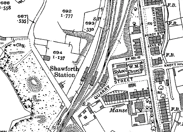 1930 1: 2,500 OS map. Buildings of identical size are shown at Shawforth station on each side of the double-track railway; their awnings are indicated but are shaded in the same way as the buildings themselves. The separate booking hall is east of the station adjacent to Quarry Street. The 1910 1: 2,500 OS map (not reproduced here) showed a brick works immediately north-west of the passenger station, served by sidings, and a tramway has been installed to carry clay downhill from a pit on the valley side. The brick works and its associated sidings have closed and been removed by 1930. The sidings east of the passenger line leading to the coal yard are still in place. The signal box is seen at the southern edge of the map, west of railway tracks. Click here for a larger version.
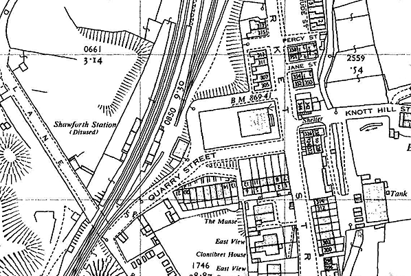
1963 1: 2,500 OS map. Shawforth station is still named and its platforms and buildings are marked, but it is identified as ‘disused’, and this description has been appended to the railway too. The coal sidings east of the line are still shown, but the approach track appears to have been severed between the booking hall and the station buildings. As late as 1967 the OS 1: 10,560 map showed the double-track railway between Facit, Shawforth and Bacup as being in situ but disused; the rails had been removed in 1964. Click here for a larger version.
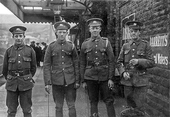
On 4 May 1915 four uniformed men wait for a southbound train at Shawforth station on their way to war. Their names are given as privates W Matthews, A Maden and J R Pickup and Corporal C Dearden. The seldom-photographed platform roofing can be seen as can two of the suspended lanterns.
Photo from Whitworth Historical Society 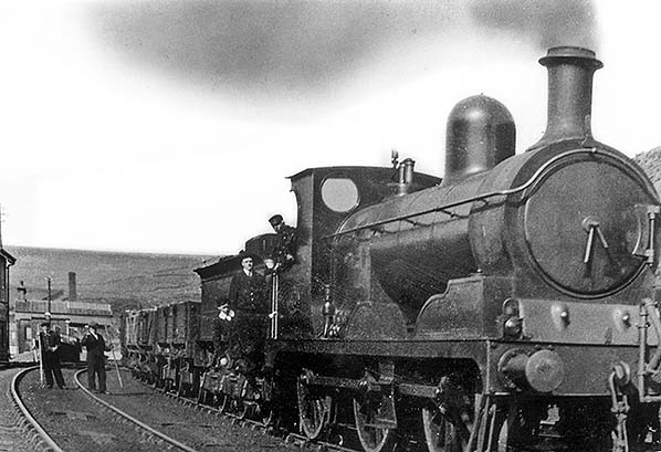
An Aspinall 0-6-0 shunts the goods yard at Shawforth circa 1910. In this northward view the signal cabin and the down platform with its awning are visible on the left.
Photo from F Collinge collection and Whitworth Historical Society 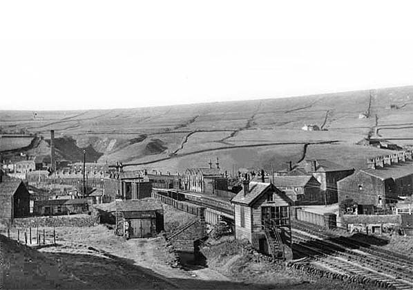 Shawforth station, looking north-east c1950s. The view is from a spoil bank on the edge of the disused quarry. Beyond the timber signal box the passenger station is seen with the distinctive triple-pitch stone buildings. The booking hall is out of sight at road level beyond the far (up) platform. Before World War 1 a loop and sidings were located on the near side of the down platform to serve a brick works and clay pit, off the picture to the left, but by the late 1920s the works had closed and the rails had been removed; there is little or no evidence of them on this photograph.
Photo from Lancashire County Council Library and Information Service 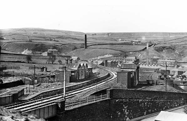
Looking north over Quarry Street towards Shawforth station in 1955. At this time, although the double-track railway is in place it has officially been closed since 1952, and the rails have been left in place should they be needed for storage of wagons. Both platforms and the distinctive stone buildings with their triple-pitched roofs remain intact, although the ridge-and-furrow awnings, which each building carried on the platform elevation and complemented the roofline, have gone. The booking hall is seen on the right at street level behind the sloping wall. The coal yard was reached by the siding behind the nearer (up) platform, but buffer stops have been placed behind the building so that the yard is no longer accessible. To the right of the buffer stop is the parapet above the subway entrance; a subway was necessary to provide access from the booking hall to both platforms because of the presence of the siding behind the up platform.
Photo by F W Shuttleworth
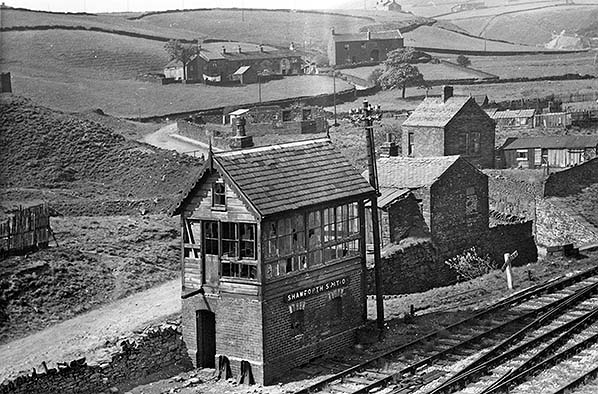
The signal box at Shawforth looking north-west on 30 May 1955. It opened with the line in 1881 and was a Gloucester Wagon Co brick-based size 2 structure with a 21-lever frame. In 1943/44 the box had ceased to be a block post, but it continued in use as a ground frame until about 1952, the year in which the line closed to all traffic. The windows have attracted the attention of vandals. Two re-railing ramps are seen: a necessary piece of equipment in the days of poor maintenance of goods
and mineral sidings. Photo by F W Shuttleworth 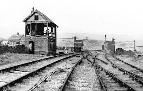 Looking north towards Shawforth station in 1959. At this time the railway is officially closed but available for wagon storage. The two platforms and their buildings are extant but, like the signal box in the foreground, are derelict, Click here for Shawforth Station Gallery 2:
|
 The railway from the south approached Shawforth through a cutting, with a loop on the up (east) side extending behind and beyond the platform to reach a four-track coal yard north of the station. Coal was supplied to the booking hall by means of a chute which was installed adjacent to the track leading to the coal yard; coal was shovelled directly from a wagon down the chute to a coal bunker on the lower level. On the down side another loop extended from the south to north of the station passing behind the platform. At the south end of the loop a siding led to Isaac Law’s quarry; it was installed circa 1882 and taken up in 1913/14, with the connection removed in 1917. Further north was a siding to Shawforth Brick Co; the firm also owned an incline which extended from their works up the valley side to a clay pit. The brick works closed in 1910.
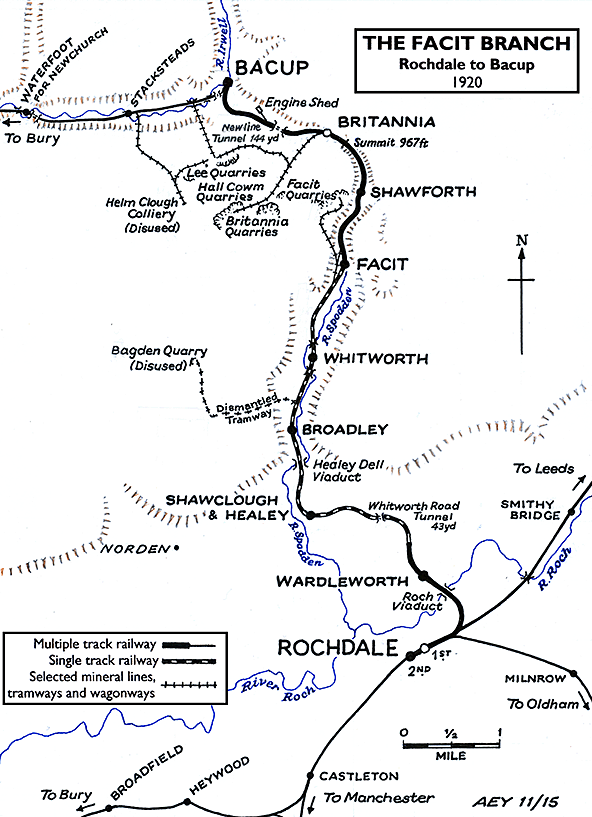

 Home Page