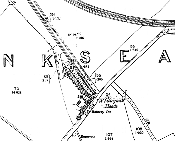
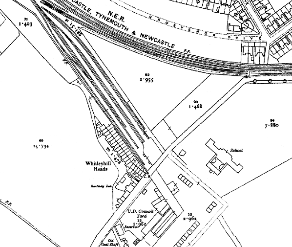
Note: Research by J C Dean has unearthed B&T deposited plans from 1866 which show a station building on the east side of the double track railway with a signal cabin on the opposite platform. There were also sidings on the east side.
BRIEF HISTORY OF BLYTH & TYNE RAILWAY (Hartley-Monkseaton ‘Avenue Branch’; Monkseaton / Whitley Bay / Tynemouth area)
| The southern end of the Blyth & Tyne Railway has a complicated history. Until 1861 there was a single route south from Blyth and Seghill through Prospect Hill to Percy Main, with a terminus adjacent to the NER station. However that year a new branch was opened, following the route of the former Whitley Waggonway, extending from Hartley to Tynemouth. It should be noted that this included the stretch to what is now |
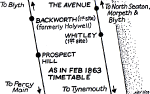 |
Monkseaton, which was to be known as the ‘Avenue Branch’, and that the line beyond to Tynemouth was half a mile inland of the present day Monkseaton – Tynemouth Metro line.
At the Tynemouth end the original terminus was quickly replaced with a new one on a short branch which curved south-eastwards, and that in turn closed when its branch was extended to a third terminus, which adjoined the 1847 Tynemouth terminus of what had been the Newcastle & North Shields Railway. These developments are shown on the series of accompanying maps.
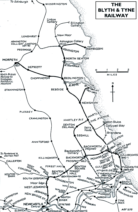 |
In 1864 the Blyth & Tyne reached Newcastle, with its terminus at New Bridge Street. This was achieved by diverting trains onto a new line just south of Holywell, through Backworth, Benton, and Jesmond. From Backworth a new line was opened to join the 1861 Whitley (Monkseaton) to Tynemouth route. Trains could now travel on the B&T from Newcastle (New Bridge Street) to Tynemouth, making the Holywell – Prospect Hill – Percy Main route, and the Avenue Branch between Hartley and Whitley (Monkseaton) redundant. These two lines closed in June 1864 on the day when the Newcastle – Tynemouth service was inaugurated. In June 1904 the Avenue Branch reopened to passenger traffic.
 |
In 1874 the B&T was absorbed by the NER, and the opportunity was taken to reorganise the railway routes in the Monkseaton / Whitley / Tynemouth area. With the growth of housing and holidaymaking on the coast the ‘inland’ route from Monkseaton to North Shields was superseded in 1882 by one within sight of the sea, and the two formerly competing termini at Tynemouth were replaced with a splendid new through station. This created the coastal section of the familiar Coast Circle and Metro route, although there were to be realignments at Whitley Bay in 1910 and Monkseaton in 1915 where new, larger stations were built.
Click here for a list of sources and a Blyth & Tyne bibliography
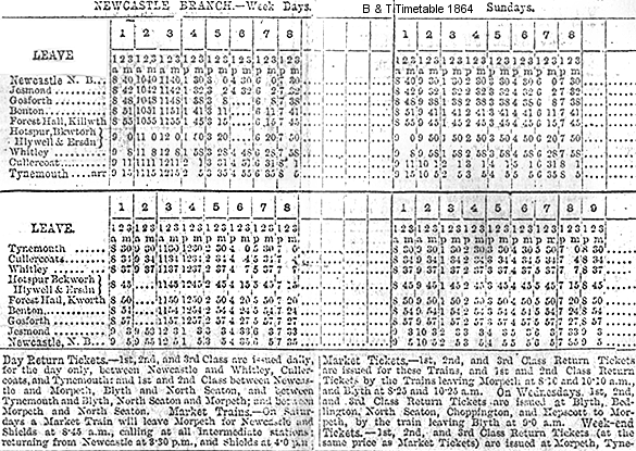
1863 Bradshaw from Alan Young, Blyth & Tyne timetable from CJ Dean. Route map drawn by Alan Young.
To see other stations on the Blyth & Tyne Railway Avenue branch click on the station name: The Avenue, Dairy House, Monkseaton (1st site), Whitley, Cullercoats (1st site), Tynemouth (1st site), North Shields (B & T) & Tynemouth (3rd site)
See also Seaton Sluice and the unopened Collywell Bay branch: Brierdene & Collywell Bay
See also
West Monkseaton, Monkseaton (2nd site), Whitley Bay (2nd site), Cullercoats (2nd site) & Tynemouth (4th site)
See also
Tynemouth (Newcastle & Berwick terminus) |

4.jpg)
.gif)
5.jpg)
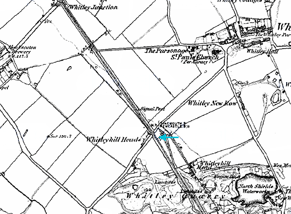
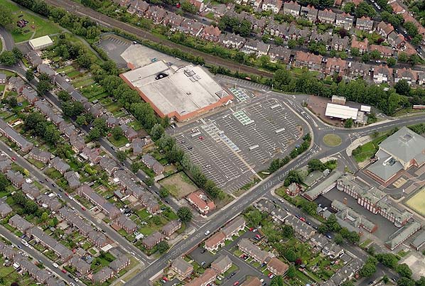 This aerial view shows the site of Whitley Junction (top left). The line of trees to the left of Morrisons follows the course of the railway, the later sidings now being occupied by Morrisons and its car park. To the south of Hilheads Road the alignment can still be followed as a property boundary fence. Whitley station was to the west of this fence line.
3.JPG)
6.jpg)

 Home Page