Note: Cullercoats is a long-established fishing village. The opening of the railway through Cullercoats (1st) probably had little impact on the community as the station was too far inland to be convenient, but when the railway was re-routed close to the coast in 1882 and a new station provided, the sandy bay with its low cliffs and caves attracted people from Newcastle at weekends. Cullercoats was also chosen as a dormitory suburb for Newcastle, and terraced two-storey housing was added to the old single-storey fishermen’s cottages. On the sea front some large terraced houses were constructed for the well-to-do, accompanied by the impressive church dedicated to St George, built in 1884 by the Duke of Northumberland as a memorial to his father.
1.gif) |
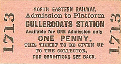
In comparison with its neighbours of Monkseaton, Whitley Bay and Tynemouth, Cullercoats station is a much more modest structure with far more cramped platforms, and stronger similarity in character to the suburban West Jesmond. Nevertheless it is an interesting and attractive station. In 1911 Cullercoats issued 271,939 tickets, a substantial quantity, but only |
half of Whitley Bay’s figure.
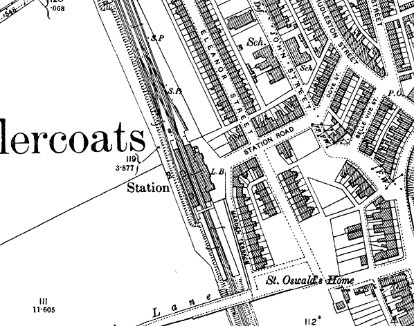
The station was opened with the new alignment of the railway between Whitley and Tynemouth in 1882, and it replaced the first Cullercoats station on the old route. As at the other three coastal stations, the main facilities at the new Cullercoats were on the east side, closest to the coast. The building was contemporary with present-day Tynemouth and resembled it, though constructed on a reduced scale; however it more closely resembled South Shields, built three years earlier than Cullercoats, and now demolished.
| The central feature of the single-storey brick buildings was a hipped slate roof for the booking hall and offices, flanked by ridge-roofed, gabled structures. A two-storey stationmaster’s house, demolished in the early 1970s, adjoined the northern end of the buildings. A covered NER footbridge at the south end of the buildings connected the platforms; there were covered |
 |
staircases on its north and south sides providing access to the west platform, but on the other platform such a staircase was only on the north side. The signal box (long since demolished) was at the north end of the east platform.
The verandahs on both platforms were originally of ridge-and-furrow design, and were salvaged from the ex-Newcastle & Berwick, later NER, Tynemouth station; however, although the original ironwork remains in place, glazed roofing with a single longitudinal ridge replaced the earlier roof in the 1920s.
In autumn 1900 Cullercoats station was flooded to above platform level. A train was derailed on entering the flood waters, and the stranded passengers were rescued by boats from the nearby beach. Boat owners took advantage of the unfortunate passengers by charging them a fee (3d) for conveying them to safety. Flooding occurred again in 1905.
Sidings were provided to the north of the station: two west of the passenger lines and entered from the south, and one to the east, also entered from the south, but with a head-shunt ending close to the signal box. A further siding ran southwards behind the west platform. The goods facilities closed on 10 February 1964.
 |
The Coast Circle route from Newcastle Central to Jesmond, with Manors (North) replacing New Bridge Street, was opened on 1 January 1909, but until 1917 the new link was used only by Newcastle Central – Benton trains. The summer 1920 timetable shows trains every half hour throughout the day on weekdays, with a more intensive rush hour service, and an hourly service |
on Sundays. Express services, some of them routed via the East Coast main line between Heaton and Backworth, called at Cullercoats. By the late-1930s the half-hourly service had increased in frequency to 20-minute intervals on weekdays and half-hourly on Sundays. On summer Sundays in the mid 1950s the same frequency was provided, sometimes with ‘extras’ at particularly busy times; there were hourly Sunday trains in the winter.
| In the LNER era ‘mint imperial’ style electric lamps were installed, carried on swan-neck standards or suspended beneath the platform awnings. The company’s policy was to provide small nameplates to accompany the electric lamps, which they did at Cullercoats. The LNER also fitted running-in boards of a style believed to be unique to the ‘Coast Circle’ |
 |
incorporating the company’s early diamond logo. In January 1948 the station became part of the nationalised British Railways North Eastern Region, then in January 1967, when the North Eastern Region was abolished it was transferred to the Eastern Region. The LNER nameboards were in place well into the British Railways era, being replaced with tangerine vitreous enamel boards in about 1960. LNER nameplates were retained until 1971; totem signs were never fitted.
 |
The familiar 1937 electric multiple units on the Coast Circle were eventually condemned as ‘life expired’ by British Rail, and phased out over a two-year period to be replaced with diesel multiple units; the final EMU ran on 17 June 1967. The diesel units provided a slower service, and the longstanding 20-minute frequency of trains was reduced to half-hourly intervals; however an express service each hour called at Cullercoats. The new Tynerider branded services – the same old DMUs with jolly orange transfers added to them! – were introduced in October 1970, restoring the 20-minute interval service. By this time the station began to look neglected. In 1971 the inadequate LNER lighting was removed and tall, vandal-proof standards were installed. In 1973 black-and-white ‘corporate identity’ signage was added, and soon afterwards the tangerine running-in boards were removed.
 |
Royal Assent was granted in 1973 for conversion of the route to light rail ‘Metro’ operation, and the DMU service continued as before, until the direct trains between Newcastle Central and West Monkseaton were withdrawn on 23 January 1978 for Metro engineering work to take place. Newcastle could still be reached by train using the route via Tynemouth, but |
these trains ceased on 10 September 1979. Less than a year later, on 11 August 1980 the station reopened on the first phase of the Tyne & Wear Metro, with trains to Tynemouth and the new Haymarket station in central Newcastle.
old20.jpg) Flood at Cullercoats station in October 1927
Flood at Cullercoats station in October 1927 |
As at the neighbouring coast stations it was decided to retain the buildings when Cullercoats became a Metro ‘halt’. The brickwork was cleaned and the verandahs were refurbished. The covered footbridge, which was a visual asset to the station – and a welcome one when it was raining! – was also retained. The station is a pleasant place to wait for a train. When the author last used the station he was serenaded by instrumental |
music of Mozart, which added a wonderful ambience. This was an initiative of Nexus, the operator of the Metro, to soothe passengers and deter vandalism. At Shiremoor Metro station (between Backworth and West Monkseaton) it was discovered that broadcasting Delius’ music through the loudspeakers was particularly effective in driving vandals away, or reforming them.
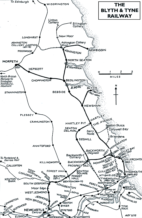
BRIEF HISTORY OF BLYTH & TYNE RAILWAY (Hartley-Monkseaton ‘Avenue Branch’; Monkseaton / Whitley Bay / Tynemouth area)
| The southern end of the Blyth & Tyne Railway has a complicated history. Until 1861 there was a single route south from Blyth and Seghill through Prospect Hill to Percy Main, with a terminus adjacent to the NER station. However that year a new branch was opened, following the route of the former Whitley Waggonway, extending from Hartley to Tynemouth. It |
 |
should be noted that this included the stretch to what is now Monkseaton, which was to be known as the ‘Avenue Branch’, and that the line beyond to Tynemouth was half a mile inland of the present day Monkseaton – Tynemouth Metro line.
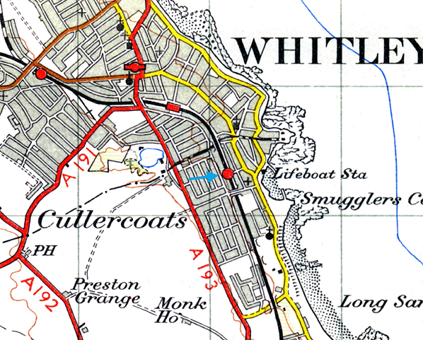
At the Tynemouth end the original terminus was quickly replaced with a new one on a short branch which curved south-eastwards, and that in turn closed when its branch was extended to a third terminus, which adjoined the 1847 Tynemouth terminus of what had been the Newcastle & North Shields Railway. These developments are shown on the series of accompanying maps.
.gif) |
In 1864 the Blyth & Tyne reached Newcastle, with its terminus at New Bridge Street. This was achieved by diverting trains onto a new line just south of Holywell, through Backworth, Benton, and Jesmond. From Backworth a new line was opened to join the 1861 Whitley (Monkseaton) to Tynemouth route. Trains could now travel on the B&T from Newcastle (NewBridge Street) to Tynemouth, making the Holywell – Prospect Hill – Percy Main route, and the Avenue Branch between Hartley and Whitley (Monkseaton) redundant. These two lines closed in June 1864 on the day when the Newcastle – Tynemouth service was inaugurated. In June 1904 the Avenue Branch reopened to passenger traffic.
 |
In 1874 the B&T was absorbed by the NER, and the opportunity was taken to reorganise the railway routes in the Monkseaton / Whitley / Tynemouth area. With the growth of housing and holidaymaking on the coast the ‘inland’ route from Monkseaton to North Shields was superseded in 1882 by one within sight of the sea, and the two formerly competing termini at Tynemouth |
were replaced with a splendid new through station. This created the coastal section of the familiar Coast Circle and Metro route, although there were to be realignments at Whitley Bay in 1910 and Monkseaton in 1915 where new, larger stations were built.
Click here for a list of sources and a Blyth & Tyne bibliography
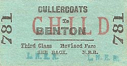
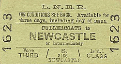
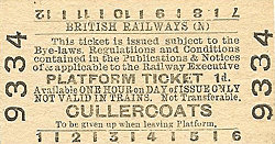
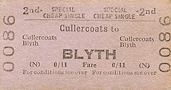
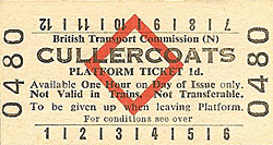
Tickets from Michael Stewart except 9135 JC Dean. 1887 & 1922 Bradshaws from Chris Totty. Route map drawn by Alan Young.
To see other stations on the Blyth & Tyne Railway Avenue branch click on the station name: The Avenue, Dairy House, Monkseaton (1st site), Whitley, Cullercoats (1st site), Tynemouth (1st site), North Shields (B & T) & Tynemouth (3rd site)
See also Seaton Sluice and the unopened Collywell Bay branch: Brierdene & Collywell Bay
See also
West Monkseaton, Monkseaton (2nd site), Whitley Bay (1st site), Whitley Bay (2nd site) & Tynemouth (4th site)
See also
Tynemouth (Newcastle & Berwick terminus) |

old13.jpg)
old1.jpg)
old16.jpg)
old3.jpg)
old5.jpg)
old11.jpg)
4.jpg)
3.jpg)
4.jpg)
.gif)
old21.jpg)
old14.jpg)
old2.jpg)
7.jpg)
old_thumb19.jpg)
old_thumb15.jpg)
old_thumb17.jpg)
old_thumb8.jpg)
old_thumb4.jpg)
old_thumb18.jpg)
old_thumb7.jpg)
old_thumb9.jpg)
old_thumb10.jpg)
old_thumb12.jpg)
thumb5.jpg)
thumb4.jpg)
thumb5.jpg)
thumb6.jpg)

 Home Page