Notes: Ann Street Halt was situated on the Widnes and St Helens line which opened on 21 February 1833 as the St Helens & Runcorn Gap Railway (SH&RGR). Built primarily for the movement of coal from the St Helens Coal field to a dock on the River Mersey (Widnes Dock) at the Runcorn Gap the line did carry passengers from its first year of operation, but there were no intermediate stations between the dock and St Helens.
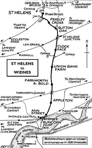 |
On 21 July 1845 the S&RGR became the St Helens Canal & Railway Company (SC&RC) when it merged with its competitor the Sankey Canal Company. In following years the original line was improved through doubling and the elimination of two inclined planes, and the overall network of the SC&RC expanded. From June 1850 intermediate stations were provided along the line, and passenger services improved. By this time many factories had been built in the areas around the Widnes Dock and the town of Widnes had begun to develop. On 31 July 1864 the SC&RC was taken over by the London & North Western Railway (LNWR) which carried out major improvements at Widnes including new lines and a locomotive shed.
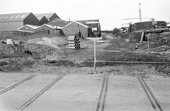
By the early twentieth century Widnes had spread northwards from the river, and one of the areas that had developed as housing for factory workers was Newtown. The settlement was located on the west side of the Widnes and St Helens line and abutted it at Ann Street, where there was a level crossing. |
The LNWR improved the frequency of the passenger service between St Helens and Widnes through the introduction of a rail-motor on 1 November 1911. (For many years trains had actually run on to Ditton Junction two miles to the west and had provided connections with main line services running between Liverpool and the south, since it opened in 1871.) To gain extra passengers two halts were opened when the rail-motor was introduced, one of them being at Ann Street, ideally located to serve the Newtown area of Widnes.
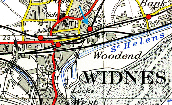
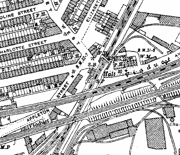
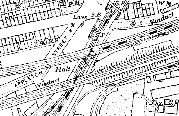
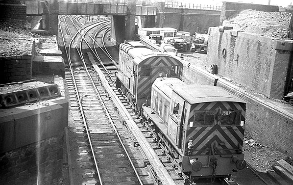
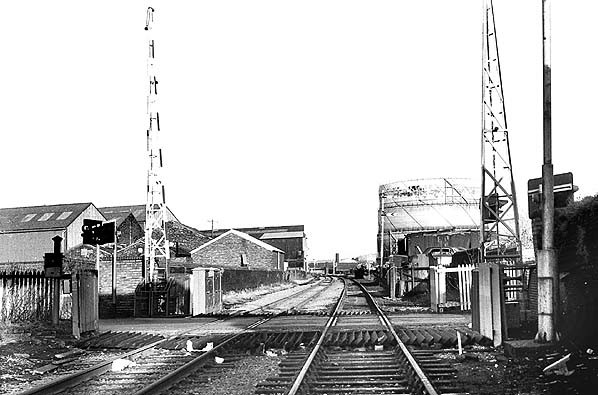
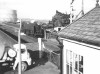
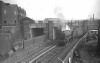
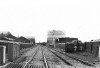
Ann Street Halt was located on the south side of the level crossing. The crossing was at that time controlled by the Widnes No 2 signal box which was a LNWR Type 4 with wooden top on a brick base containing a 30-lever frame. The box had opened in May 1895 replacing an earlier one which opened in 1869 and was west of the line (the up side) to the south of the crossing. The up platform (St Helens direction) was immediately south of the signal box; the down platform (Ditton Junction direction) was directly opposite. The short platforms were of timber. Space was extremely limited for immediately south of the platforms was a junction for Widnes locomotive shed. Immediately to the south of that junction was a further one where a spur line diverged from the original route to Widnes Dock and curved westwards at a climbing gradient to join the Widnes Deviation line; this was one of the LNWR improvements and had opened in November 1869. The deviation was part of a through route between Garston and Warrington, and since 1 March 1870 there had been a station on it called Widnes. The purpose of the spur was to allow St Helens trains to call at Widnes station and then travel onwards towards Ditton Junction.
 |
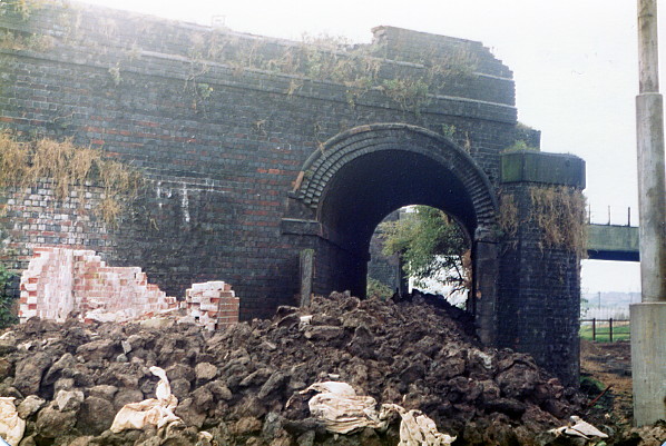
To complicate matters further, two bridges passed over the line at the location of the halt. Running east-west the southernmost bridge at the end of Ann Street’s platforms was the deviation line. The next bridge, also running east-west passed directly over the halt and carried the Great Central & Midland Widnes Joint Line (GCR/MR) which had opened at this point on 1 August 1879 and had no physical connections to the LNWR system.
There is no evidence that Ann Street Halt had any form of shelter: the GCR/MR bridge probably being sufficient to protect passengers from the elements. Passengers would have had to purchase their tickets from the guard on the train.
On the north side of the level crossing there was a footbridge but being on |
the other side of Ann Street from the halt it was of little use to the halts passengers.
When Ann Street Halt opened seven services ran in each direction on weekdays. The rail-motor was given the nickname of the ‘Ditton Dodger’. Because the service proved to be very popular the rail-motor provided insufficient seating for passengers. It was replaced with LNWR Webb Coal Tank locomotives and coaches fitted to operate in push-pull mode. The name Ditton Dodger for the service stuck and continued to be used by local people, both passengers and railwaymen.
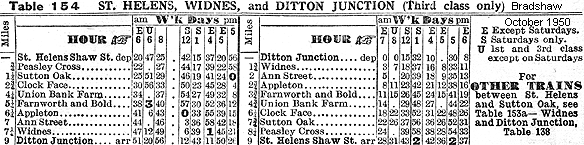
In July 1922 there were still seven up services to St Helens Shaw Street and seven down to Ditton Junction as shown in the table below. On Sundays there were no trains.
| Up Departures (St Helens Direction) July 1922 |
Destination |
Down Departures (Ditton Junction Direction) July 1922 |
Destination |
| 7.11am |
St Helens Shaw Street |
6.47am |
Ditton Junction |
| 10.15pm |
St Helens Shaw Street |
8.58am |
Ditton Junction |
| 12.12pm Saturdays Only |
St Helens Shaw Street |
11.44am |
Ditton Junction |
| 12.22pm Saturdays Excepted |
St Helens Shaw Street |
2.34pm |
Ditton Junction |
| 2.57pm |
St Helens Shaw Street |
4.54pm |
Ditton Junction |
| 4.11pm |
St Helens Shaw Street |
6.41pm |
Ditton Junction |
| 5.37pm |
St Helens Shaw Street |
9.11pm |
Ditton Junction |
| 7.06pm |
St Helens Shaw Street |
|
|
At the railway grouping on 1 January 1923 the LNWR was absorbed into the London Midland & Scottish Railway (LMS). In September 1931 the Widnes No 2 signal box had its frame extended to 35 levers. This was because it took over the junction into the locomotive sheds when Widnes No 3 box closed on Sunday 27 September 1931. The LMS summer timetable for 1932 showed an improvement in the service with thirteen trains to St Helens Shaw Street and eleven to Ditton Junction, but there were still no Sunday trains. The start of the World War II on 3 September 1939 saw the Ditton Dodger service reduced to only three trains in each direction in the morning and three in the evening with none between 8.30am and 4.15pm. The line had always been more important for goods services, and it was busier than ever during the war years.
After the war the service was not restored to its previous levels. On 1 January 1948 Ann Street became part of British Railways London Midland Region. (By that time the ‘Halt’ suffix appears to have been dropped; the use of this suffix for LNWR rail-motor stations was always inconsistent.) The summer timetable for 1948 showed the same level of service as the war years as seen in the table below.
| Up Departures (St Helens Direction) Summer 1948 |
Destination |
Down Departures (Ditton Junction Direction) Summer 1948 |
Destination |
| 7.05am Saturdays Excepted |
St Helens Shaw Street |
6.44am Saturdays Excepted |
Ditton Junction |
| 12.20pm Saturdays Only |
St Helens Shaw Street |
8.46am |
Ditton Junction |
| 1.39pm Saturdays Only |
St Helens Shaw Street |
1.03pm Saturdays Only |
Ditton Junction |
| 4.18pm Saturdays Excepted |
St Helens Shaw Street |
1.41pm Saturdays Only |
Ditton Junction |
| 5.09pm Saturdays Excepted |
St Helens Shaw Street |
4.58 pm Saturdays Excepted |
Ditton Junction |
| 5.35pm |
St Helens Shaw Street |
5.42pm Saturdays Excepted |
Ditton Junction |
| 6.13pm Saturdays Excepted |
St Helens Shaw Street |
6.22pm |
Ditton Junction |
In 1951 British Railways proposed the withdrawal of the ‘Ditton Dodger’ service and complete closure of Ann Street. Despite local opposition the service was withdrawn from 18 July 1951, the very last train having departed for Ditton Junction at 6.18pm on Saturday 16 July 1951. The halt was demolished shortly after. During the 1950s a new brick and concrete footbridge was built on the south side of the crossing.
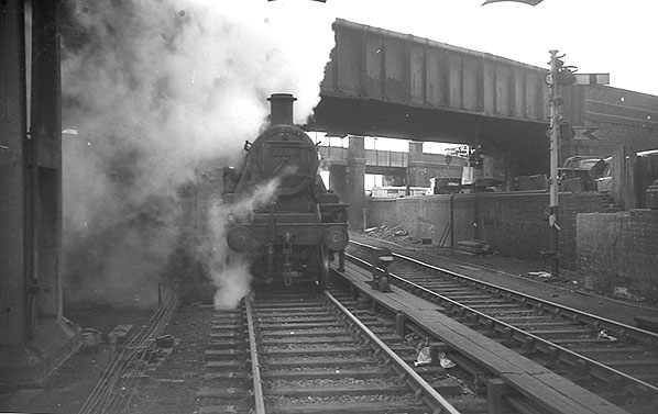
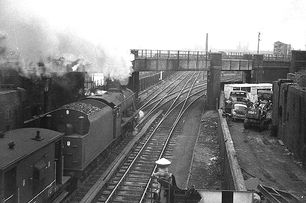
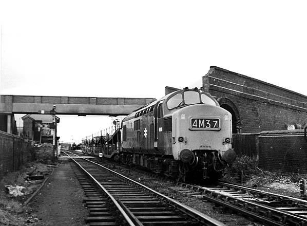
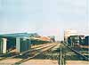
The line itself remained busy throughout the 1960s. On 13 April 1964 Widnes locomotive shed (by that time carrying the shed code 8D) was closed. On 4 November 1968 the original line southwards to Widnes Dock was taken out of use and lifted by 1970. A variety of freight trains continued to pass through the site of Ann Street Halt as did the occasional passenger diversion, despite the fact that the line had been reduced to goods status in December 1967.
On Sunday 30 December 1973 Widnes No 2 box was closed and quickly demolished. In the early weeks of 1974 the wooden level crossing gates at Ann Street were removed, and on 13 January 1974 replacement electronic barriers were operational controlled by Widnes No 1 box which lay half-a-mile to the north.
 |
The last passenger train to pass through the site of Ann Street Halt was a rail tour, the Palatine, from London Euston. It passed Ann Street on the St Helens to Ditton Junction leg of its route at 3.56pm on 25 April 1981. On the 31 October 1981 a class 40 (40 124) passed through the site of Ann Street Halt and headed north towards St Helens and onwards to Wigan. It was the last movement over the line between Widnes and St Helens as on the 1 November 1981 it closed as a through route. Trains continued to pass through the halt running as far Widnes No 1 box where they performed a reversal to use a spur to Tanhouse Lane sidings (formerly part of the GCR/MR line and connected to the St Helens line since 1961), where they served the Blue Circle cement works for a short period until the line was closed completely on 18 April 1982. A new spur had been put in from the deviation line to Tanhouse Lane which allowed the remaining section of the original SH&RGR at Widnes to close. By June 1982 the track at Ann Street had been lifted.
In 1984 a road was constructed along the course of the line from the site of Widnes No 1 box to Ann Street obliterating the sites of the level crossing and the halt. A decade later the road was widened and extended under the deviation line. In 2012 nothing remained of Ann Street Halt.
The 8D Association - Dedicated to promoting the history of South Lancashire and North Cheshire railways. Web Site
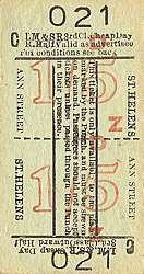
Ticket from Michael Stewart
Sources:
- The St Helens Railway, Its Rivals and Successors – J M Tolston – The Oakwood Press 1982
- The Widnes to St Helens Railway in Halton 1833 - 1982 - P T Wright - Halton Borough Council 2008
- Bradshaws Rail Times July 1922 - Guild Publishing 1986
- British Railways London Midland Region Timetable May 31st - September 26th 1948
To see the other
stations on Widnes - St. Helens line click on the station name:
Runcorn Gap, Appleton,
Farnworth & Bold,
Union
Bank Farm Halt, Clockface,
Sutton Oak, Peasley Cross, St Helens (1st), St Helens (2nd) & St Helens (3rd)
See also:
Widnes 1st, Widnes South, Ditton
And see related features:
Widnes Dock Junction and Widnes Locomotive Shed
|

street6.jpg)
.jpg)
street_thumb6.jpg)
street_thumb7.jpg)
.jpg)

 Home Page