
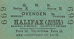
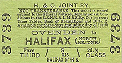
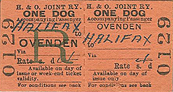
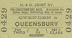
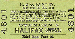
Station Name: OVENDEN[Source: Chris Armour]
Ovenden Station Gallery 1: c1910 - c1940s old10.jpg) Looking north towards Ovenden station from Ladyship Terrace c1910. Ovenden Brook is seen on the right; it runs under the line just before the station and then behind the up platform. The stationmaster's house is seen on the right and in the distance Old Lane bridge at the north end of the station.
Photo from John Mann collection 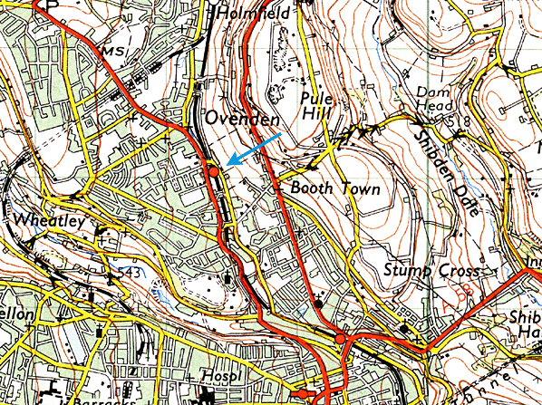 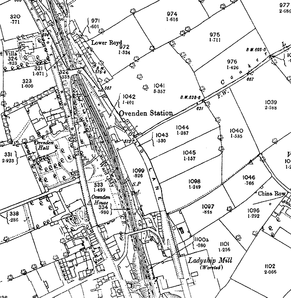 1894 1:2,500 OS map shows Ovenden station as built. The main station building is seen on the down (Halifax) side with the stationmaster's house set back from the platform to the south. Main access is along a steep approach road from Old Lane with an alternative path down the side of the cutting also from Old Lane to the station forecourt. Although not obvious as it is not shaded, the waiting room is seen opposite the main building on the up platform. There is a steep path down to the up platform from Old Lane bridge.
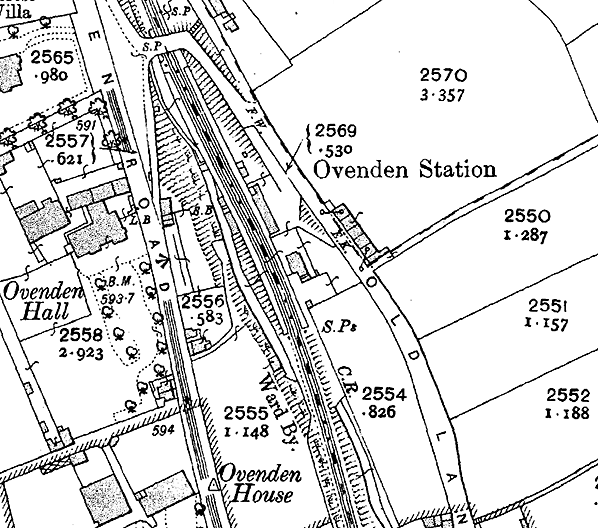 1907 1:2,500 OS map. At first glance little has changed but a signal box is now shown on the up platform just north of the station building. A new access path has been provided on the up side, twice the length of the earlier path, and presumably less steep.
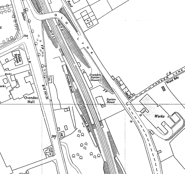 1962 1:2,500 OS map. The station had been closed to all traffic since 1955. The track remained in use until June 1960. Although this map was published in 1962 the survey would have made several years earlier when the line was still open. The removal of the north end of the up platform is apparent.
old9.jpg) Crowds gather on the down platform in 1916. The station was not usually as busy as this, so this may have been and excursion or, as the photo appeared in a local paper it is more likely to be the departure of troops for the Western Front in WW1. The main access road is seen on the left with the alternative path up to Old Lane running from the station forecourt. The steep path from Old Lane bridge to the up platform is seen on the right. The chimney of the Ladyship Mills is seen in the background.
 This time the crowds are there to catch an excursion service to Halifax and beyond. We get a rare view of the signal box adjacent to the up platform waiting shelter. The box was closed circa early 1930s and quickly demolished. The access path from Old Lane bridge to the up platform is seen on the right. old9.jpg) A Queensbury-bound goods train is seen in the up platform at Ovenden station c 1930s. The front loco running tender first, is an ex-GNR Ivatt J1 0-6-0. In LNER days a few of these were based at Bradford. The second loco is more difficult to identify but it appears to be a class 04/3 ex-ROD 2-8-0.
Photo
by G W Sharpe
old5.jpg) A view south from Old Lane circa late 1930s. The vehicle and pedestrian access to the station forecourt from Old Lane is clearly seen. Although only a short distance from the centre of Halifax the rural surroundings are evident. The scene along Ovenden Road (out of view to the right) is completely different with housing, industry and even the town police station only yards from here.
old7.jpg) At some time, probably in the late 1930s, the up platform was substantially shorted with the removal of its north end. The newly painted platform edge seen on both sides suggests that the north end of the down platform is also no longer used. Ladyship Mills are seen in the background.
Photo from Jim Lake collection old3.jpg) The down platform at Ovenden station seen from the up platform c 1940s. By this date the remaining southern section of the down platform has also been replaced in concrete. Photo from John Mann collection Click here for Ovenden Station Gallery 2:
|
 Notes: The Lancashire & Yorkshire Railway opened a line connecting Halifax, Bradford and Keighley between 1874 and 1879. The three lines met Queensbury station which was rebuilt in a triangular layout in 1890. The line was mostly rural and necessitated the construction of many earthworks, viaducts and tunnels. Its hilly nature earned it the nicknames of 'the Alpine route' or 'the switchback' from its loyal drivers.
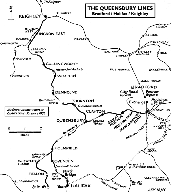
 Ovenden station had no goods facilities and the buildings were constructed cheaply from wood as passenger expectations were not great. It is therefore ironic that it is the only station building to survive on this route, outliving the stone-built stations. There were two facing timber platforms with the main station building on the down side at the end of steep approach road. The single-storey rectangular building with a pitched slate roof incorporated the ticket office, waiting room and toilets. There was a two-storey stone stationmaster's house at the south end of the building set back from the platform. Passenger access was along the approach road or down a steep path from Old Lane, opposite the booking office. There was also a path down to the north end of the up platform. The up platform was provided with a timber waiting shelter with a hipped slate roof opposite the main building. Around the turn of the twentieth century a signal box was provided on the up platform, opposite the station building. This box had been closed and was demolished by the early 1930s.
 At some time, probably in the late 1930s, the up platform was reduced in length by removal of the north end, almost up to the waiting shelter. The remainder of the platform was later replaced in concrete.
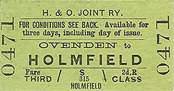

 Home Page