|
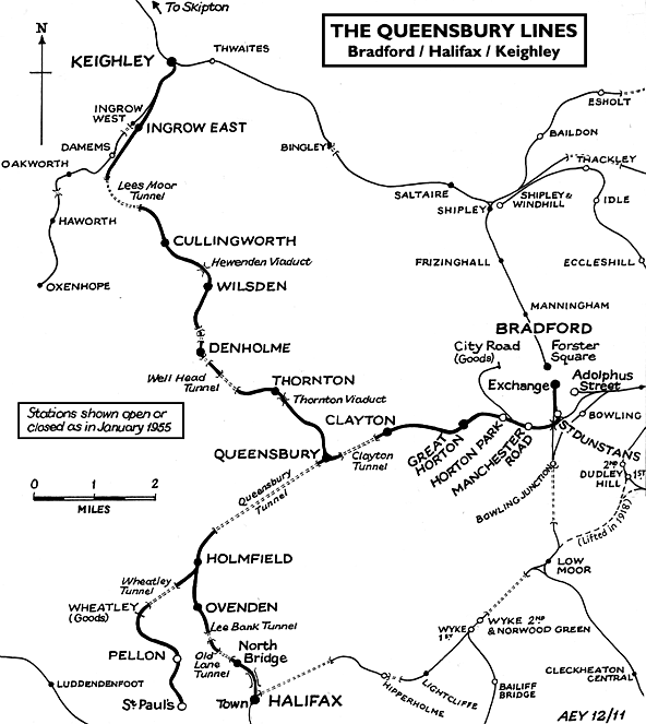
Notes: The line from Bradford to Thornton via
Queensbury was opened as a joint venture between the Lancashire
& Yorkshire Railway and the Great Northern Railway between
1876 and 1878. Once out of Bradford, the line was mostly rural
and necessitated the construction of many earthworks, viaducts
and tunnels. Its hilly nature earned it the nicknames of 'the
Alpine route' or 'the switchback' from its loyal drivers. Although
the National Archive record the station as opening 14.4.1897
it appeared in Bradshaw before the end of 1878 but the first
stopping train is shown as May 1879.
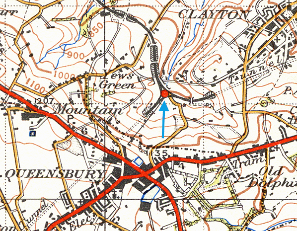
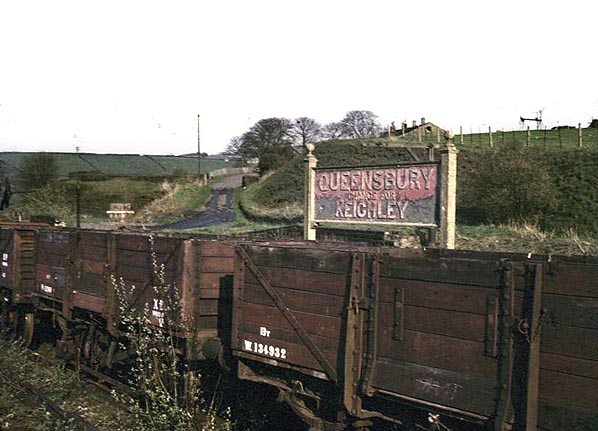
Queensbury station was fairly unique, having a triangular layout
with platforms serving all three directions; the only other
local example is Shipley, which only covered two sides of the
triangle until the 1980's. When the 'new' Queensbury station
was opened in 1.1.1890, only Ambergate in Derbyshire had a similar
layout.
 |
The following is an extract from Railway Magazine, February 1950: "It is also noteworthy in that all three sides find roughly equal use. Queensbury is situated at the divergence of the Bradford – Halifax and Bradford – Keighley lines and the third side of the triangle is provided by the direct line between Halifax and Keighley. An unusually ample train service is provided |
in all three directions from Bradford to both Halifax and Keighley and between Halifax and Keighley, and certain of these trains connect at Queensbury, although traffic here is considerably less than in days before bus competition robbed the railway of many of its passengers.
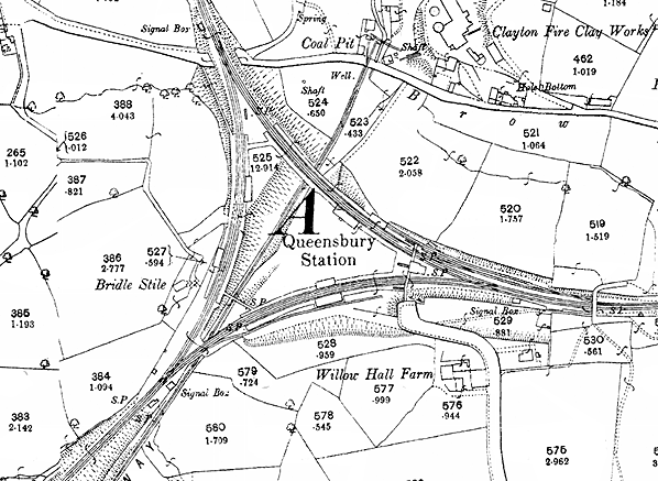
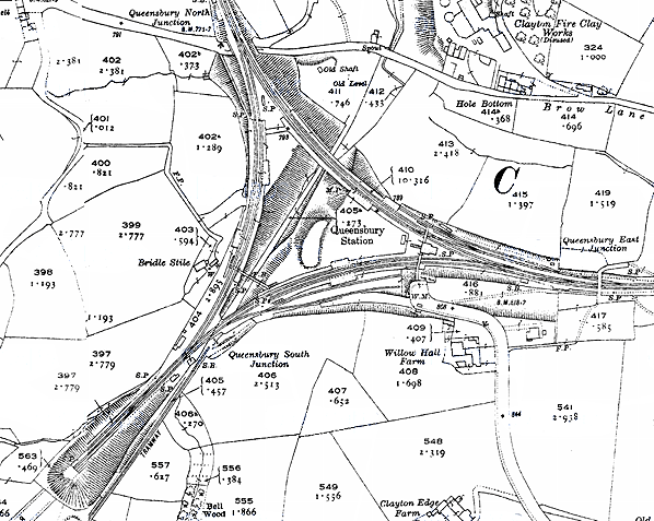
The station is remarkable in having six independent sets of railway offices, all of them timber structures of typical Great Northern outline which include waiting rooms and lavatories; in addition, a booking office and other station buildings stand on an overbridge at the Bradford corner of the triangle. Platforms for the most part and platform fences almost entirely, are of timber, and timber maintenance must have been a considerable item in relation to the modest traffic now handled at the station.
The Bradford – Keighley side of the triangle is carried in part on a three-arch stone and masonry viaduct; and at the Halifax end a subway is provided to connect the four platform ends. A passenger entering the station for a train to Halifax or Keighley may find, if it is a through Halifax – Keighley train that he has to walk the full length of a platform and half the length of another in order to reach it."
| Queensbury claims to be the highest village in the UK at a
height of 1,150 ft above sea level. Unfortunately, the only
place where the station could be built was down a mile long
dimly lit footpath 400 ft lower than the township. Even so,
the station had to be built on an escarpment built up with rubble
and earthworks.. Although fairly well used by local
residents, the station |
 |
was of more use as an interchange between
the three lines.
Goods services were minimal, being a few small coal mines which
closed fairly early in the station's history and a local brickworks;
the striped chimney of which serves as a convenient landmark
in the photographs.
Upon leaving Queensbury for Halifax, trains had to enter the
Queensbury tunnel underneath the village. At 1 mile 741 yards
long, this was the fourth longest tunnel in West Yorkshire.
Water seepage in the tunnel was always a problem and the subsequent
damage to the tunnel lining was cited as one of the reasons
for the closure of the line. Towards the end, enormous icicles
forming in the tunnel in winter caused damage to trains, so
a small engine had to be parked in the tunnel at night producing
enough steam to melt the ice.
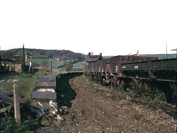
All passengers services were withdrawn on 23rd May 1955 but the station remained open for goods traffic until 11th November 1963 although after closure to passengers it was downgraded to an unstaffed public delivery siding. After complete closure of the station there was still some through goods traffic and the last passenger train to call at the station was the West Riding Railtour on 6th September 1964. The track was finally lifted back to Horton Park in June 1966.
 |
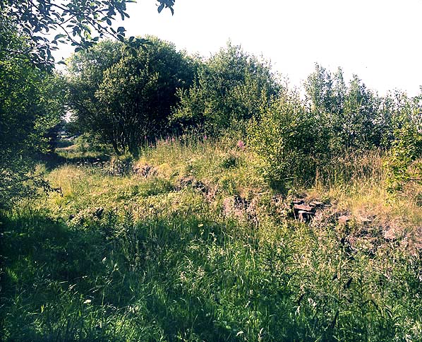
The site has poor road access and the ground is too muddy to
be of any commercial use today, but this has not stopped the
whole station from being demolished. By 1970 only very degraded remains of the platforms and the station subway under the Halifax - Keighley platforms could be seen. The station house
remains, which is in private ownership. Even the subway was |
eventually demolished c.2004,
possibly for the valuable Yorkshire stone used in its construction.
In May 2005 a section of the railway was brought back to life
as the Great
Northern Trail. The first section of the new trail runs
from Cullingworth to Harecroft Eventually the new trail will
cover a distance of 10 kilometres between Queensbury and Cullingworth
but it will be five years before it is completed.
The new trail is available for walkers, cyclists and horse
riders and is also suitable for wheelchairs. The section of
the trail already open includes two viaducts including the listed
Hewenden
Viaduct near Cullingworth
Other web sites: The
Lost Railways of West Yorkshire & Queensbury
Village web site
Further reading: The Queensbury Triangle by Alan
Whittaker 1979.
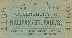
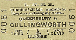
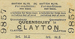
Route map drawn by Alan Young. Tickets from Michael Stewart
To see the other stations on
the Halifax - Bradford - Keighley lines click on the station
name: Halifax
St. Pauls, Pellon,
Halifax North
Bridge, Ovenden,
Holmfield, Clayton,
Great Horton,
Horton Park, Manchester
Road, St. Dunstan's,
Bradford
Adolphus Street, Thornton,
Denholme, Wilsden,
Cullingworth
& Ingrow East |

old2.jpg)
old6.jpg)
old3.jpg)
old1.jpg)
old4.jpg)
11.jpg)
 Home Page